


Voting District 0810024000002, Kent County, Michigan
About
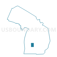
Outline

Summary
| Unique Area Identifier | 597261 |
| Name | Voting District 0810024000002 |
| County | Kent County |
| State | Michigan |
| Area (square miles) | 1.58 |
| Land Area (square miles) | 1.58 |
| Water Area (square miles) | 0.00 |
| % of Land Area | 99.71 |
| % of Water Area | 0.29 |
| Latitude of the Internal Point | 42.95204030 |
| Longtitude of the Internal Point | -85.52944810 |
Maps


Graphs
Select a template below for downloading or customizing gragh for Voting District 0810024000002, Kent County, Michigan


Neighbors
Neighoring Voting District (by Name) Neighboring Voting District on the Map
- Voting District 0810024000001, Kent County, MI
- Voting District 0810024000006, Kent County, MI
- Voting District 0810024000007, Kent County, MI
- Voting District 0813402000004, Kent County, MI
- Voting District 0813402000005, Kent County, MI